Rim Trail
Grand Canyon National Park, AZ
The Rim Trail is a flat, mostly paved trail that runs for approximately 13 miles along the South Rim of the Grand Canyon in Grand Canyon National Park. The trail is an easy walk and provide a great and beautiful overview of the canyon. We actually walked from Mather Point to Bright Angel Trailhead on the first afternoon we arrived at the canyon and then walked from South Kaibab Trailhead to Mather Point after hiking the South Kaibab trail the next day. The track below puts these two walks together as if they were one walk.
Walk-Specific Map
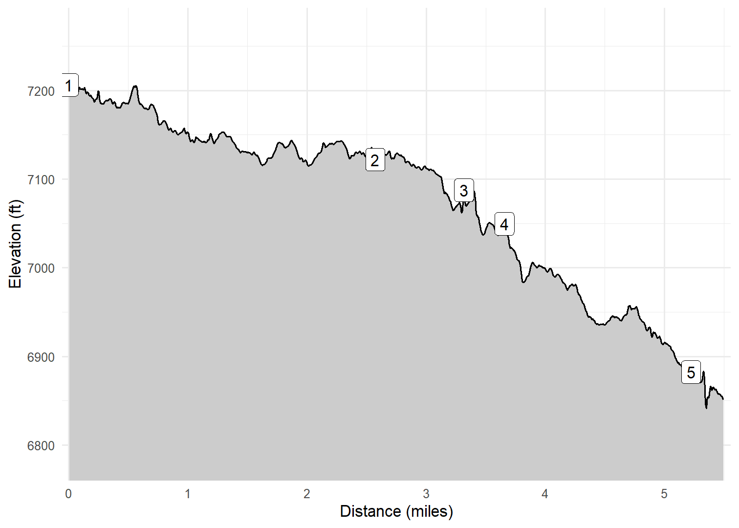
Elevation Profile
Images

GCSRIM01: Elk along trail

GCSRIM01: Elk along trail

GCSRIM02: Kim along the rim

GCSRIM02: Canyon view

GCSRIM02: Canyon view

GCSRIM02: Canyon view

GCSRIM02: Kim and I

GCSRIM03: Canyon view

GCSRIM03: Canyon view

GCSRIM04: Canyon view

GCSRIM04: Canyon view

GCSRIM04: Canyon view
GPX Download
A sanitized GPX file of our hike is here.
Summary Information
| NUM | trackID | Primary | Description | Distance | CumDist | DeltaElev |
|---|---|---|---|---|---|---|
| 1 | GCSRIM01 | South Rim Trail | Yaki Point to Mather Point | 2.57 | 2.57 | -84 |
| 2 | GCSRIM02 | South Rim Trail | Mather Point to Yavapai Point | 0.74 | 3.32 | -34 |
| 3 | GCSRIM03 | South Rim Trail | Yavapai Point to Grandeur Point | 0.34 | 3.66 | -38 |
| 4 | GCSRIM04 | South Rim Trail | Grandeur Point to El Tovar Lodge | 1.57 | 5.22 | -167 |
| 5 | GCSRIM05 | South Rim Trail | El Tovar Lodge to Bright Angel Trailhead | 0.28 | 5.50 | -29 |